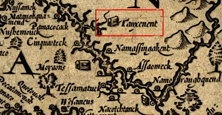
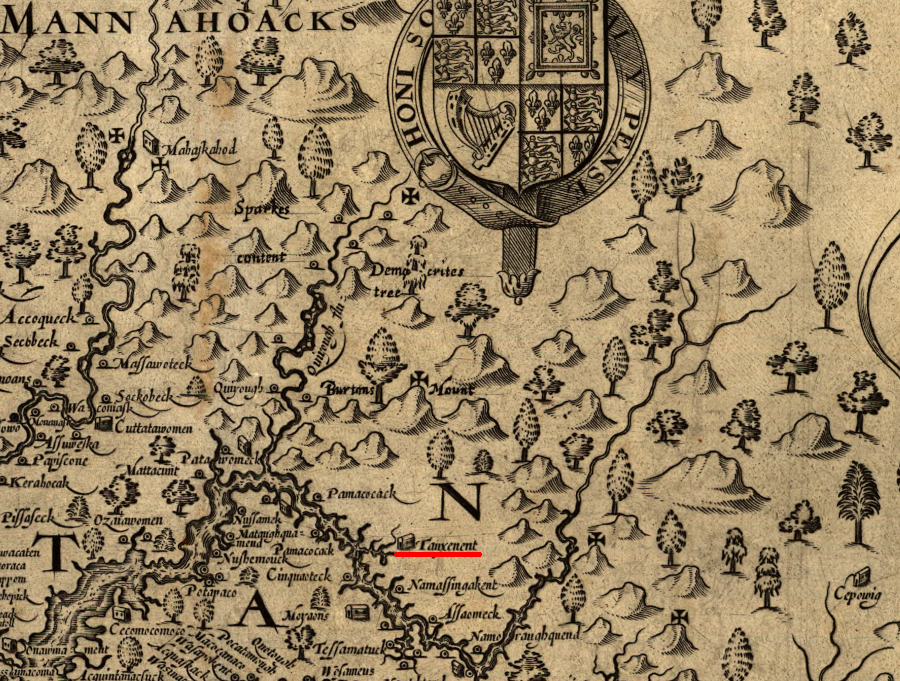
Tauxenent was the main town of the Moyumpse, also known as the Dogue
Source: Library of Congress, Virginia (by John Smith, 1624)
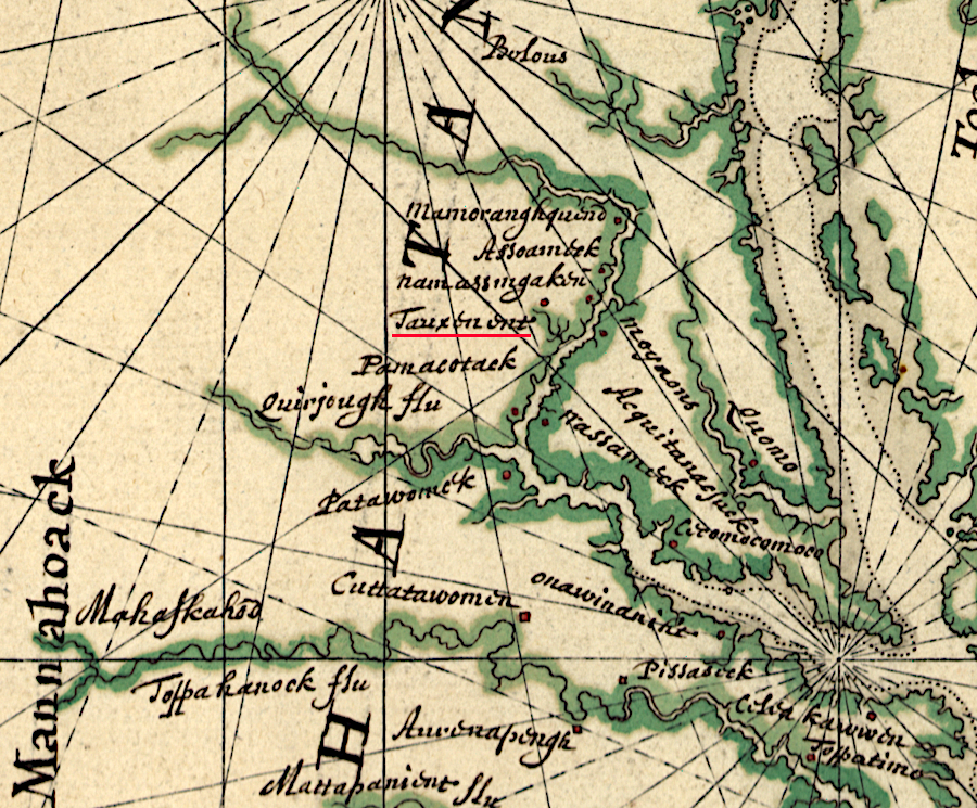
Tauxenent was the main town of the Moyumpse, also known as the Dogue
Source: Library of Congress, Virginia (by John Smith, 1624)
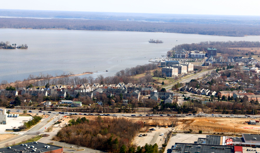
When John Smith sailed up the Potomac River in 1608, he encountered an Algonquian-speaking tribe at the mouth of the Occoquan River. Smith recorded 40 men capable of serving as warriors at their main town called Tauxenent. In contrast, he thought the Patawomeck had 160 "able men," the Moyowances had 100, and the Nacotchtanke had 80.1
The ancestors of those tribes had settled long ago at the mouths of streams flowing into the Potomac River, after adopting the pattern of growing corn for a large percentage of their diet. The original campsites of the first Native Americans in the area 15,000 years ago were underwater. The campsites were drowned as the ice sheet melted, sea level rose, and the Chesapeake Bay formed.
After the Native Americans began relying upon corn around 900CE (Common Era), towns were created where estuaries provided food and soil was suitable for agriculture. Before the adoption of agriculture in the Woodland Period about 3,000 years ago, small bands of Native Americans roamed through the region on seasonal rounds. Those bands stayed for just a brief time until the food that was easy to hunt and gather had been exhausted. The farmers who started growing crops near the mouth of the Occoquan River migrated away, were displaced, or established new cultural identities as tribal groups reorganized over time. The Paleo-Indians who had arrived as much as 20,000 years earlier were mobile. The Moyumpse/Tauxenant (Dogue) living north of Aquia Creek, the peope that John Smith met in 1608, had not been living in that one location for all that time. A new group apparently migrated into the area between Quantico and Mason Neck in the middle of the 1500's, about 50 years before the English settled Jamestown.
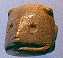
soapstone carving of beaver or otter, made around 1360 CE (Common Era) by a Dogue living next to mouth of the Occoquan Rive
Source: Fairfax County, A Very Rare Find
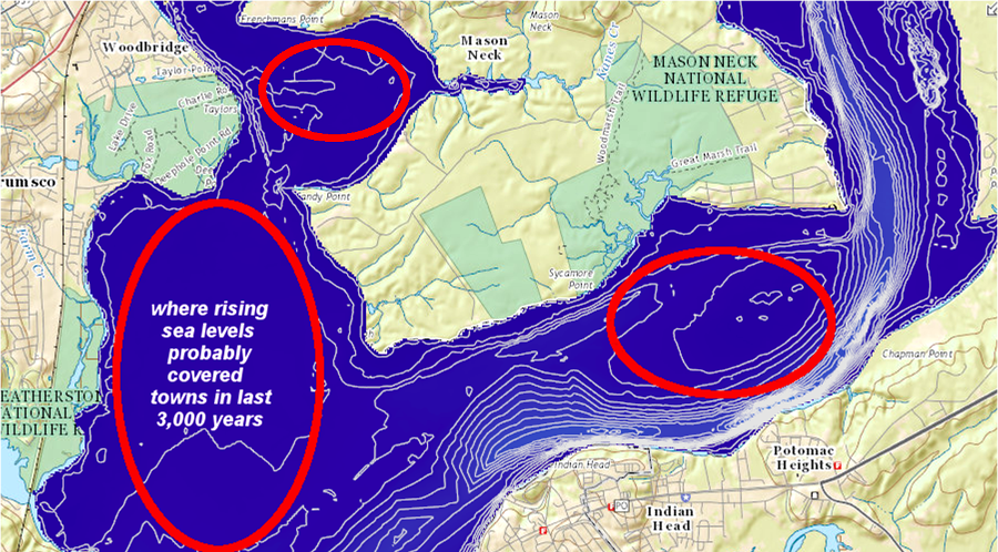
homesites of the ancestors to the Moyumpse (Dogue) are probably underwater now, on the flats overlooking the ancient Potomac River channel where there was easy access to anadromous fish
Source: ESRI, ArcGIS Online
The people Smith that knew as the Taux (Tauxenant) may have called themselves the Moyumpse. Their rivals to the south, such as the Patawomeke/Patawomeck, used the pejorative term "Dogue" to refer to the Moyumpse. Since the English associated most closely with the tribes controlled by Powhatan, by 1660 "Dogue" was the standard name among the colonists.2
the Taux/Moyumpse/Dogue lived along the shoreline of the Potomac River, in what today are Prince William and Fairfax counties
Source: Library of Congress, Pascaert van Nieuw Nederlandt Virginia, ende Nieuw-Engelandt verthonendt alles wat van die landin by See, oft by land is ondect oft Bekent (by Johannes Vingboons, 1639?)
The rival tribes were unfamiliar with the English language when they first used the word Dogue, so it did not refer to dogs. Those animals had already been domesticated when the first people crossed from Beringea into the heart of the North American continent, and the Virginia tribes used them for hunting turkeys.3
Into the 1800's, whites focused on racial classifications sought to associate Native American tribes with Europeans or the "lost tribes" of Israel. In 1686 Rev. Morgan Jones claimed he had sailed from Virginia to South Carolina, been stranded onshore, and walked back through the Coastal Plain to Virginia. During that eight-month walk, he was supposedly among the Tuscaroras when he discovered that they spoke Welsh.
The story was one of several efforts to assert that Welsh sailors had reached North America before Columbus, and that Native Americans adopted elements of the Welsh culture and language. Rev. Morgan made a fantastical claim that he was abput to be executed, after getting so close to Virginia, when he spoke out and was rescued at the last minute by a Dogue leader:4
Occoquan Bay, once the home of the Moyumpse (Dogue) and now the Belmont Bay development
Source: Historic Prince William, Rt. 1 and Belmont Bay - #107
West of the Fall Line, the Manahoacks and Monacans were rival Siouan-speaking nations. The border zone may have been perhaps where Manassas and Centreville later developed. The language difference, if correctly recorded by John Smith and others, suggest that two separate cultures occupied what is now Northern Virginia when Europeans arrived.
Moyumpse/Dogue living at Tauxenent controlled access to seafood resources which could have been traded with the Manahoacks living near the Blue Ridge
Source: Library of Congress, Virginia (by John Smith, 1624)
There is little historical evidence of interactions between those Manahoac and Moyumpse/Dogue cultures. Hunters must have encountered each other in the woods around Great Falls, which would have been an attraction for prehistoric tourists just as it is today. Moyumpse/Dogue had easier access to seashells from the Chesapeake Bay and seafood from the Tidewater rivers; the Manahoac had better access to high-quality stone for tools. In planned meetings or in accidental encounters, people from two cultures probably negotiated to exchange dried fish and shell ornaments for rhyolite and jasper stone cores from the Blue Ridge.
English colonists documented few Native American trails for trade between the Siouan-speaking Monacan/Manahoacks and Algonquian-speaking Moyumpse/Piscataway communities
Source: Yale University Library, Indian Trails of the Southeast (by William E. Myer, 1928)
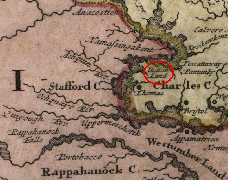
After the Third Anglo-Powhatan War that started in 1644, English colonists displaced the Moyumpse/Dogue from Dogue Neck (now known as Mason Neck). Some of the Moyumpse/Dogue appear to have moved across the Potomac River and chosen to live with the Piscataway in Maryland; others apparently migrated south to the Rappahannock River. They blended into the cultures of the Piscataway and Rappahannock and lost their specific identity as "Moyumpse/Dogue."5
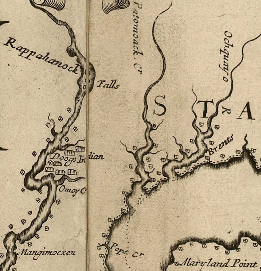
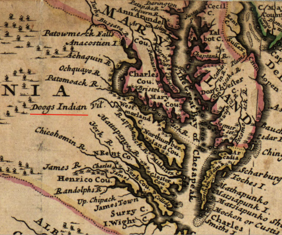
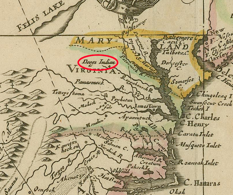
in 1670 Augustine Herrman documented the "Doogs" living along the Rappahannock River
Source: John Carter Brown Library, Virginia and Maryland As it is planted and Inhabited this present Year 1670 (by Augustine Herrman, 1670)
after colonial settlement was authorized north of the Rappahannock River, the Moyumpse/Dogue were displaced and many blended into the Piscataway tribe in Maryland
Source: Library of Congress, Virginia, Marylandia et Carolina: in America septentrionali Brittannorum industria excultae (by Johann Baptist Homann, 1714)
In 1666, the Piscataway had been weakened greatly by raids from the Iroquois. To gain protection provided by the Maryland colonists, the tayac of the Piscataway signed "Articles of Peace and Amity" in the name of 11 other tribes, including the "Doags."6
a 1731 map showed the "Doogs" living upstream of the Fall Line
Source: Library of Congress, A new and exact map of the dominions of the King of Great Britain on ye continent of North America (by Herman Moll, 1731)
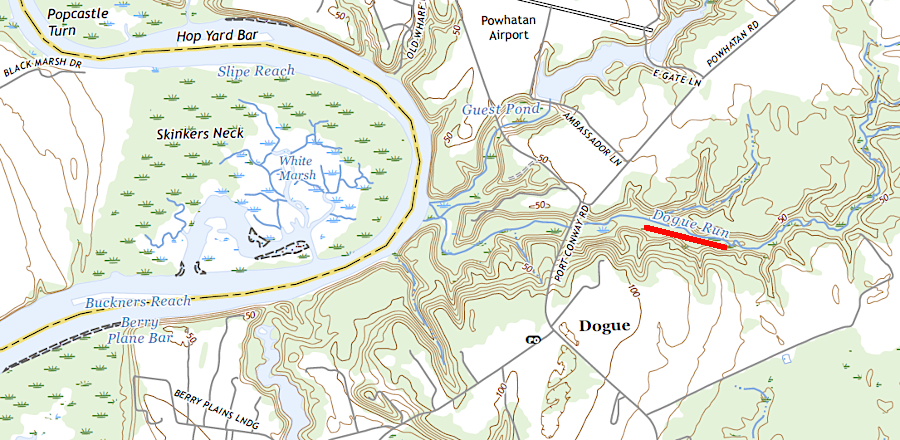
the presence of the Moyumpse (Dogue) is still recorded in King George County place names
Source: US Geological Survey (USGS), Port Royal VA 1:24,000 topographic quadrangle (2022)
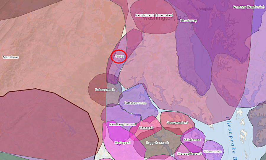
the Moyumpse (Dogue) were associated with the Piscataway when English colonists arrived in Virginia
Source: Mid-Atlantic Regional Council on the Ocean, Mid-Atlantic Ocean Data Portal
the Moyumpse (Dogue) were shown living on the Rappahannock River in 1673
Source: John Carter Brown Library, A New Map of the English Plantations in America (Blathwayt Atlas, 1673)