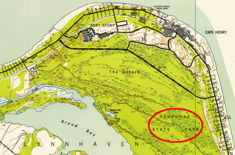
First Landing State Park was originally named Seashore State Park
Source: US Geological Survey (USGS), Cape Henry VA 1:24,000 topographic quadrangle (1952)
First Landing State Park was originally named Seashore State Park
Source: US Geological Survey (USGS), Cape Henry VA 1:24,000 topographic quadrangle (1952)
First Landing State Park was initially called Seashore State Park. When Virginia was creating a system of state parks in the 1930's, it was planned as the "park by the seashore." The "park in the mountains" was named Shenandoah National Park, but the park in Princess Anne County kept the name Seashore State Park for over 60 years.1
The sand, swamps, and pine barrens at Cape Henry (known as "the Desert") were not suitable for grazing or farming. During the colonial period, almost all the land there was retained in government ownership. Between 1770-72, applications for purchase of land triggered Princess Anne County residents to send a petition to the General Assembly. The local residents camped on the shoreline when catching fish, and they requested that it:2
In 1806 3,118 acres were surveyed, but that parcel was not sold by the Commonwealth of Virginia until 1869. Virginia donated land south of the park in 1914 to the Federal government for establishment of Fort Story. That facility was named after General John Patton Story, who was a commander in the coast artillery.3
The state acquired the majority of the park's land from the Cape Henry Association in 1933. Between 1933-1936, Civilian Conservation Corps workers, mostly African-American men, built the first camping facilities, visitor contact stations, and trails. Seashore State Park was one of the first six units opened in 1936 by Virginia State Parks.
Additional lands were added later via donations and from the Federal government's Fort Story. Today, First Landing State Park has 2,888 acres. There are 20 miles of trails, 1.5 miles of beach along the Chesapeake Bay, cabins, campsites, and the Chesapeake Bay Center with exhibits.
The park's name was changed officially in 1997 to First Landing State Park, in preparation for the commemoration of the 400th anniversary of settlement at Jamestown.4
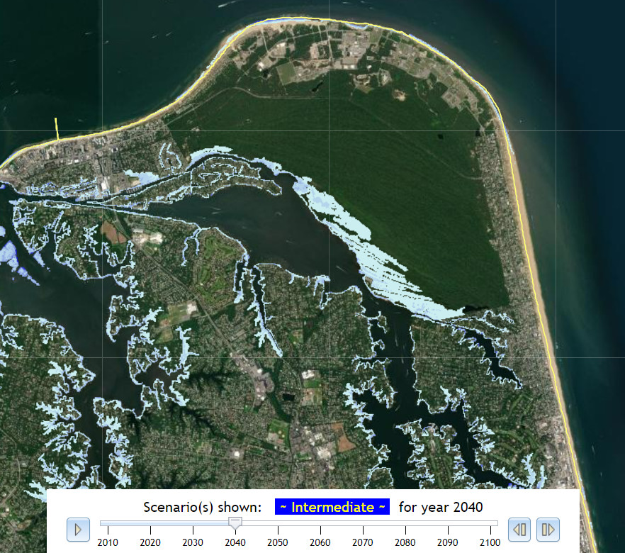
in the Intermediate scenario for sea level rise, by 2040 the high ground of First Landing State Park is only slightly affected
Source: Commonwealth Center for Recurrent Flooding Resiliency, Sea Level Rise Projection
The sand dunes at Cape Henry started to form 5,000 years ago, as sea level was rising and the Chesapeake Bay was beginning to take its final shape. The oldest dunes are at the southern edge of the park next to Linkhorn Bay. Next to the campground on the northern edge of the park, the dune is only 125 years old.5
The age of the sediments in the dunes is determined through luminescence dating. Photons accumulate in the lattice of crystals, especially quartz and potassium feldspar, as they are exposed to ionizing radiation from alpha particles (α), beta particles (β), gamma rays (γ) and cosmic rays. The photons begin to accumulate in the dark when sediments are buried. If exposed to direct sunlight or heated above 300°F, the photons are released.
Scientists seeking dates based on luminescence excavate sediments (ensuring no light gets into the trench during the process) and, in the laboratory, heat a sample. The length of time sediments have been buried can be determined by measuring the number of photons being released. The more photons that had accumulated in the lattice of the molecular crystals, the older the sample.6
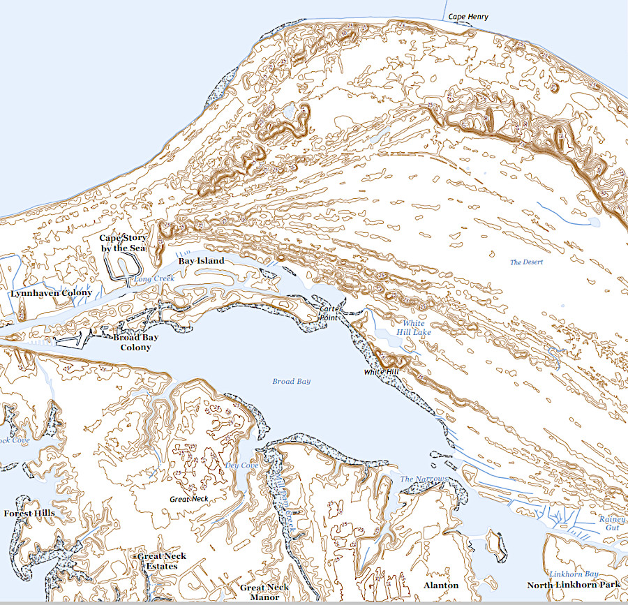
sand ridges are 5,000 years old in the south and 125 years old in the north at First Landing State Park
Source: US Geological Survey, Cape Henry VA 1:24,000 scale topographic quadrangle (2022)
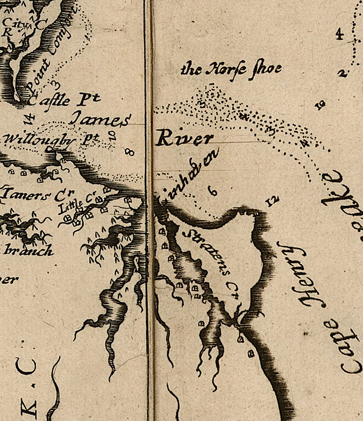
in 1670, Augustine Herrman mapped Cape Henry as part of an island
Source: John Carter Brown Library, Virginia and Maryland As it is planted and Inhabited this present Year 1670 (by Augustine Herrman, 1670)