by 2026, the Virginia Marine Resources Commission managed 23 artificial reefs
Source: Virginia Marine Resources Commission, 119 US dredge Talcott dredging James River, Virginia
by 2026, the Virginia Marine Resources Commission managed 23 artificial reefs
Source: Virginia Marine Resources Commission, 119 US dredge Talcott dredging James River, Virginia
Colonists viewed the natural reefs in the Chesapeake Bay and Tidewater rivers as navigation challenges. To avoid running aground, ships had to sail within deep channels between shallow shoals and underwater rocks.
Lighthouses and buoys were constructed so captains and navigators could recognize hazardous locations. During the Revolutionary War and the War of 1812, British ship captains relied upon local pilots who often had escaped enslavement to avoid running aground.
Since the Civil War, oyster reefs have been dredged away, channels have been dredged, and the Coast Guard maintains a network of buoys identifying the channel edges. The National Atmospheric and Oceanic Administration (NOAA) produces charts showing locations and depth of channels. Still, commercial ships today hire local pilots who are knowledgeable about currents and channels to get between the mouth of the Chesapeake Bay and the dock of a port.
Creation of artificial reefs in the Chesapeake Bay, Tidewater rivers, and the Atlantic Ocean reflects the recognition that habitat restoration is important along with navigation. Fish populations increase where hard surfaces are available on the bottom of the bay, rivers, and ocean, adding diversity to the soft sediments that have eroded off the land.
The creation of a hard bottom to increase aquatic populations and "Save the Bay" has required human intervention. Most of the natural oyster reefs were destroyed by excessive dredging and disease by the 1950's.
The first artificial reefs in Virginia were developed after Worlds War II by recreational anglers. They dumped a mix of old cars and tires, plus pontoons and former US Navy landing craft no longer needed after World War II, onto the Atlantic Ocean bottom off Virginia Beach.
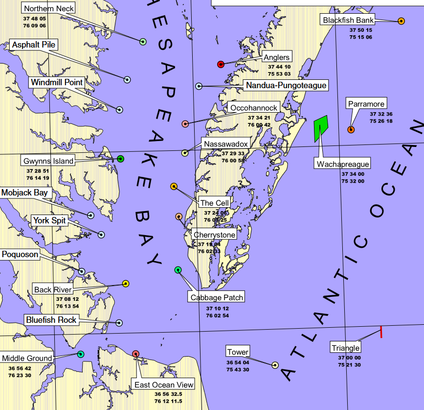
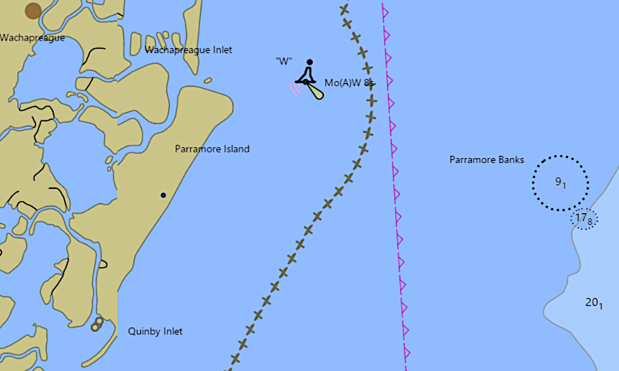
The Virginia Marine Resources Commission started building artificial reefs in the 1970's when it received a Federal government donation of six surplus Liberty Ships. Pollutants such as oil and lubricants were stripped from the six ships before they were sunk in the Atlantic Ocean to create Triangle Reef off the coastline of Virginia Beach and Parramore Reef off Wachapreague.
More ships and other materials, such as surplus concrete pipe sections, tires, and rubble from former bridges and piers, have been used to create 23 artificial reefs. The two Liberty ships sunk to create Parramore Reef have since been supplemented with a US Coast Guard barge and ship, 50 subway cars and military vehicles, plus tires in concrete that surround the center of the reef.
an artificial reef encircles the lighthouse on the Newport News Middle Ground Reef
Source: Office of Coast Survey, NOAA ENC Viewer
Blackfish Bank Reef near Assateague was started with 40 armored personnel carriers. Since 2003, 94 subway cars from New York City have been added. An artificial reef has been constructed around the base of the Newport News Middle Ground Lighthouse using reef balls, concrete rubble, buoy sinkers, piling and pier sections.
Specially-fabricated concrete structures (including reef balls, igloos, and tetrahedrons) and donated materials (primarily construction debris) are used to manufacture reefs. Materials are carefully placed to maximize the amount of hard underwater surface area and interior space. At Anglers Reef near Onancock, concrete pipe was used to construct 1,600 tetrahedrons in a circular pattern.
The reefs are located on state-owned submerged land and are managed by the Virginia Marine Resources Commission. Yellow buoys mark their location, as well as navigational charts.
Saltwater fishing license revenue helps fund the creation of artificial reefs. The primary intent of the reefs is to create biological diversity, increasing the food chain that is topped by the fish which anglers desire to catch.
The hard surfaces are populated initially by algae, barnacles, mussels, and tube worms. When those forms of life adhere to the bottoms of ships, they are considered to be "fouling" organisms and are scraped away to increase ship speeds. On the bottom of the ocean, bay, and rivers, they are food for fish and crustaceans:1
Expansion of the artificial reefs is facilitated by replacement of old Tidewater bridges. Barging concrete, asphalt, and metal rubble by water to an offshore disposal site is far cheaper and less disruptive of traffic than hauling the debris to a landfill.
The expansion of the Hampton Roads Bridge-Tunnel in the 2020's required demolition of existing trestles. 100,000 tons of debris from the bridge decks, beams, and pilings was barged into the Chesapeake Bay for placement at Bluefish Rock Reef. That reef had been started in 2007 with concrete pipe placed 4.5 miles east of Buckroe Beach.2
Experience is showing that some large items of debris are not suitable for disposal in artificial reefs:3
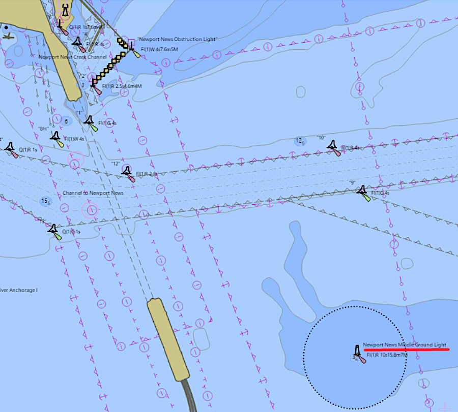
an artificial reef encircles the lighthouse on the Newport News Middle Ground Reef
Source: Office of Coast Survey, NOAA ENC Viewer