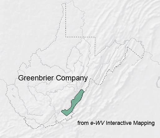
lands patented under the Greenbrier Grant ended up being in West Virginia
Source: e-WV, The West Virginia Encyclopedia Online, lands patented by the Greenbrier Company ended up being in West Virginia
lands patented under the Greenbrier Grant ended up being in West Virginia
Source: e-WV, The West Virginia Encyclopedia Online, lands patented by the Greenbrier Company ended up being in West Virginia
The land speculators who formed the Greenbrier Company included members of the Lewis family and John Robinson, who held the key offices of Treasurer and also Speaker of the House of Burgesses. They received a 100,000-acre grant from the Governor's Council on April 26, 1745. That was right after the 1744 Treaty of Lancaster in which the Haudenosaunee (Iroquois) ceded claims to the Shenandoah Valley and agreed to stay neutral in casee of war between Great Britain and France.
The Native Americans interpreted their cession to include just the territory south of the Potomac River, between the Blue Ridge and the Allegheny Mountains. They retained that perspective until the 1768 Treaty of Fort Stanwix. The Virginians, represented at the negotiations by William Beverley and Thomas Lee, claimed the cession included all lands west to the Mississippi River and north to the Great Lakes.1
The Greenbrier Company was created by group of the wealthy Virginia elite with personal and business connections to the Governor's Council, which approved land grants. The investors in the company sought to survey and establish ownership of choice land parcels in what today is West Virginia. The grant allowed the investors to claim 1,000 acres for getting up to 100 families to settle on the western edge of Virginia.
The 100,000 acre grant was more than just a post-treaty bargain for the Greenbrier Company investors. Governor Gooch was continuing the western lands policy established two decades earlier by Governor Spotswood. The colonial government consistently sought to settle Protestants who would be loyal to Virginia in the Mississippi River watershed, in preparation for conflict with the French who claimed the area.
The Greenbrier Company had to hurry and complete surveys in order to obtain patents (legal title) to specific parcels. With a patent, the company could pressure settlers moving into the western lands to pay for where they were starting to farm.
Settlers had not waited for the land to be granted, surveyed and patented by colonial officials. For many, the presumption was that they could clear land and build a cabin first, then obtain legal title later. Pre-empting the best bottomlands in the river valleys required taking high risks by occupying territory used by Shawnee hunters. It also required being willing to live far away from a source of supplies - especially gunpowder, salt, metal tools such as axes, and clothing.
When Dr. Thomas Walker traveled up the Greenbrier River, he reported on July 6, 1750 that the good lands were already getting occupied by bold farmers:2
John Lewis, a Greenbrier Company member and the official surveyor for Augusta County when it was established in 1745, deputized his son Andrew to survey parcels for the Greenbrier Company. The land office in Williamsburg was supposed to authorize patents after reviewing surveys that came only from official county surveyors with a license from William and Mary. Surveys that had been completed by their deputies and approved by county surveyors also qualified for issuance of a patent.
By 1751, surveyors were identifying parcels for sale by the Greenbrier Company. That lasted only until the outbreak of the French and Indian War, then the surveyors returned in the 1760's.
Early settlers who gambled that they could avoid paying the Greenbrier Land Company were proven correct:3